
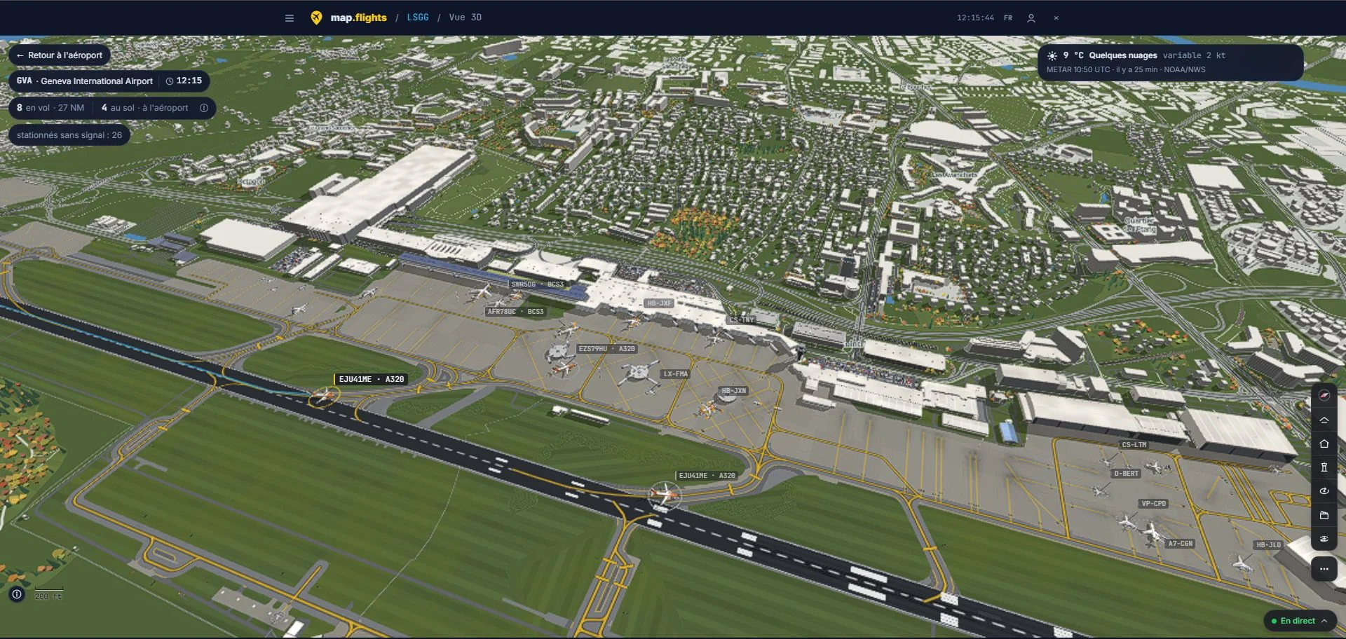

Explore Geneva in three dimensions
We chose Geneva Airport (GVA/LSGG) to introduce the service. Its 3D view shows the airport layout, including runways, taxiways and parking areas, together with aircraft tracked on the ground and nearby.
You can move and tilt the camera, switching from an overview of the airport to a closer view of a particular area or aircraft. The screenshot accompanying this article was captured directly in map.flights.
Explore Geneva in 3D on map.flights
A companion for planning your simulated flights
For flight simulation enthusiasts, ground movements can be just as interesting as departures and arrivals. Before starting MSFS 2020, MSFS 2024, FSX or Prepar3D, you can observe activity at an airport and use it as inspiration when choosing an aircraft, a destination or a flight scenario.
The service runs in a browser alongside your simulator. You can also keep it open during a session to check the movements visible around your departure or arrival airport.
Positions received by a community network
Displayed positions come in part from a network of ADS-B receivers supported by the map.flights community. Local coverage and signal reception affect the data available, so not every aircraft will necessarily remain visible at all times.
The website distinguishes estimated positions and parked aircraft without a recent signal. These labels help explain what each aircraft shown on the map represents.
Find map.flights among Rikoooo’s partners, or visit its live air traffic map directly.