Photoreal Mt Everest plus Mesh for FSX and P3D


Superb photoreal scenery that faithfully reproduces the topography of Mount Everest (high resolution) and its seroundings.
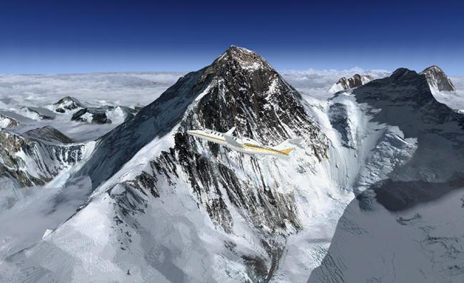
An impressive journey to the heart of the mountains! Here is a short video preview :
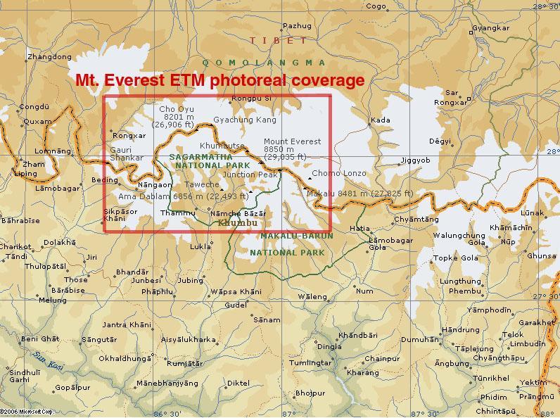
Here is the area considered for the photoreal textures of Mount Everest :
Additional information can be found in your "Start menu -> Add-ons Rikoooo -> Mt Everest photoreal more FSX & P3D Mesh -> documents and pictures "
The installation is 100% automated by Rikoooo, the configurator will handle for you the registration and activation of the scenery in Flight Simulator. When uninstalling, the installer will restore your configuration of origin.
Caution large file 524 MB, it is recommended to use a download accelerator software to pause and resume at the point of arrest to have no surprises (eg FlashGet).
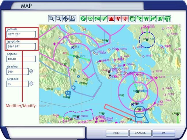
Important, how to use the scenery ? Start a flight, then during the game open the map and enter one of the GPS adress below to move directly your aircraft to the most interesting points:
- Mt.Everest photoreal textures·· N27° 28° E86° 87°
- Mt.Everest and Kula Kangri········· N26° 28° E85° 92°
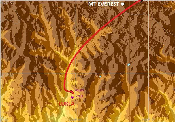
Simpler, you can start your flight from Lukla.
Lukla is a town in the Khumbu region of Nepal. It is a normal crossing point for tourists who visit the Himalayas, including Everest, in the beginning and end of their journey. Lukla is about 2860 meters above sea level.
It has an airfield (airport Tenzing-Hillary) comprising a track about 500 meters in 12 ° slope (the most dangerous in the world). This one, covered in 2001, is particularly difficult to access without landing assistance. The traffic is mainly generated by local companies providing shuttles to the airport in Kathmandu: 40 minutes flight by Twin Otter and Dornier Do 228.
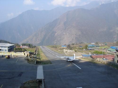
start your flight from "Lukla" must be specified in the selection of the starting point for FSX/P3D
Turn right as shown on the map below and then proceed straight to Mt Everest
Have a good flight
 LOADING ...
 File information
- Rating
Size 543 MB
Downloads 43 904
License Freeware

Auto-install Installer Scenery v11
-
Photoreal Mt Everest plus Mesh is compatible with Prepar3D v1 and FSX-Steam as well as FSX (all versions)
Author : Frank Dainese , Daniele Tona + Large mesh by Ferranti & Sandmann
- No virus guaranteed by